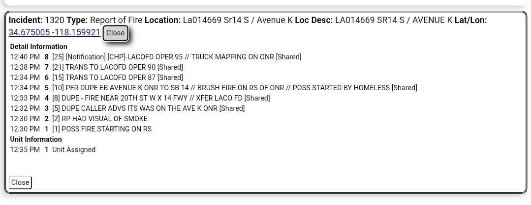
904B…E. Avenue Z and Jesus Canyon Rd…reported brush fire…law enforcement and FD enroute code 3
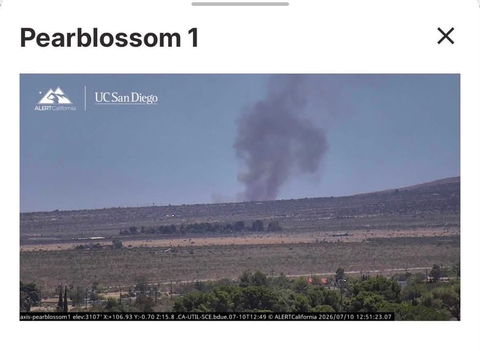
904B…E. Avenue Z and Jesus Canyon Rd…reported brush fire…law enforcement and FD enroute code 3
UPDATE: #SummitFire…large smoke column visible from miles away…San Bernardino FD sending a 1st alarm brush response
UPDATE 2: E79 in area, having access issues
UPDATE 3: SBcoFD not sending response…fixed wing and multiple copters enroute…E79 trying to make access at E 248th Street East and Fort Tejon Rd
UPDATE 3: still trying access fire…from a distance fire appears to be at 7-8 acres in moderate to heavy brush…there is an immediate structure threat
UPDATE 4: BC17 requesting a 2nd alarm brush response do to multiple homes in immediate threat…Cal Fire send a brush response
UPDATE 5: (1:18pm) Air Attack requesting the 3 closest air tankers of any type…fire burning to the east
UPDATE 6: (1:38pm)…BC17 states structure impact in 20 minutes
UPDATE 7: (1:39pm)…evacuation warning issued for region LAC-E107
UPDATE 8: (1:44pm)…2 structure protection groups in place..CHP on scene and assisting with evacuations
UPDATE 9: (1:54pm)…3 additional fixed wing tankers inbound
UPDATE 10: (1:57pm)…moving Incident Command Post to 248th Street East and Pearblossom Highway…requesting CHP for traffic control
UPDATE 11: fire at 45 acres…structure threats persist…residents on 228th Street East and 248th Street East requesting assistance evacuating
UPDATE 12: (2:04pm) Air Attack requesting a VLAT (very large air tanker) and 3 more of air tankers…structural threat is imminent
UPDATE 13: (2:07pm) Intel76 is mapping the fire at 395 acres in medium to heavy fuels with a rapid rate of spreads…potential of 1,000 acres in the next hour…mandatory evacuation notice issued for LAC-E107…Air Attack reports structures are being impacted by fire
UPDATE 14: (2:21pm) evacuation warnings issued for zones LAC-E127-C and LAC-E1340
UPDATE 15: (2:26pm) no VLATs available…Copter 22 enroute replacing Copter 18 which is having mechanical issues
UPDATE 16: (2:29pm) fire at 600 acres with a rapid rate of spread…structures have been impacted by fire per Air Attack
UPDATE 17: AC5 requesting Strike Team 1152 and 7 additional strike teams
UPDATE 18: (2:37pm) fire has made it in to the forest…Air Attack requesting a no diversion order for all aircraft on the #SummitFire due to imminent threat to life and structures…requesting two additional air tankers for a total of 10 air tankers
UPDATE 19: fire is spotting on the right shoulder of fire…structure threat continues on left shoulder and head of fire
UPDATE 20: firefighters working to keep fire west of 263rd Street East which would take the fire into much more densely populated neighborhoods
UPDATE 21: (3:04pm) fire at 620 acres with a potential of 1,000 acres in the next hour…fire in grass and light fuels with a rapid rate of spread
UPDATE 22: per Air Attack fire approximately 1.5 mile from Mountain High…requesting evacuation warnings for the area
UPDATE 23: (3:18pm) fire at 1,380 acres…Air Attack reiterating the imminent fire threat to Mountain High West and requesting units to the area
UPDATE 24: (5:55pm) Fire at 2,271 acres with 0% containment
UPDATE 25: (9:09pm) fire is now being mapped at 2,676 acres, 0% containment and all evacuation orders and warnings remain in effect
UPDATE 26: (3:25am) fire remains active…no update on acreage…all evacuation orders and warning are still in place